What vestiges of history have you encountred while fishing?

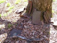
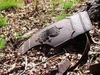
There are the remnants of two of those old dams they used to get timber down the stream on Breastworks run in Somerset county , also further upstream are the remnants of Fort Dewart and the Forbes trail , there are wagon wheel ruts worn into the bedrock on the side of the mountain , the coolest things are what gives the stream/run it's name , they are old logs stacked in a V shape called a breastwork and they were used to hide behind while being shot at and reloading flintlocks. This is all located along rt 30 west above and along the mountain where the old Ship Motel was. It was also called Noahs Ark later before it burnt down.
 
Haywood wrote:
I have a cabin in on the Francis branch of Slate Run.
You are a lucky man.
 
csoult wrote:
Haywood wrote:
I have a cabin in on the Francis branch of Slate Run.
You are a lucky man.

Yes indeed.

If you ever need someone to stay at your cabin sometimes when you aren't there, as a "caretaker", let me know!
 
I got this great little booklet (General store) about the rise and fall of Cross Fork back in the logging days. It tells the story of Ole Bull, and his land purchase, ect. Interesting read.
 

Attachments

  • IMG_1468 (Custom).JPG
    IMG_1468 (Custom).JPG
    23 KB · Views: 2
There's a small book called Pine Creek Villages that's pretty good for those interested in the history of Slate Run, Cedar Run, Cammal, Waterville etc.

http://www.amazon.com/Pine-Creek-Villages-Images-America/dp/0738556637

There's a whole series of these books for many different areas of PA. The books are made up most of photos, but with some short explanations of the history.

They have these books at Barnes & Noble.
 
troutbert wrote:
There's a small book called Pine Creek Villages that's pretty good for those interested in the history of Slate Run, Cedar Run, Cammal, Waterville etc.

http://www.amazon.com/Pine-Creek-Villages-Images-America/dp/0738556637

There's a whole series of these books for many different areas of PA. The books are made up most of photos, but with some short explanations of the history.

They have these books at Barnes & Noble.

This caught my eye at the Railroad Museum a few years ago; I got it for Christmas. Interesting read and view, as my grandparents have a cabin up on top of the plateau between Pine and Little Pine.

First two photos at this splash dam article are of a splash dam on Otter Run (trib to Little Pine) and I think at least one of them is in the Pine Creek Villages book (can't find the book at the moment).
 
salmonoid wrote:

First two photos at this splash dam article are of a splash dam on Otter Run (trib to Little Pine) and I think at least one of them is in the Pine Creek Villages book (can't find the book at the moment).

Nice photos of that splash dam on Otter Run. It looks a big splash dam. Notice how they open the gate to create the "splash." A lot of people say they used dynamite. But they had gates they could open and close so they could use the dam over and over again for "splashing" logs down, rather than dynamiting and having to build the dam over and over again.

I don't know how the gates were constructed or worked though. The pictures don't show the details well.
 
Wonderful thread!

I simply love the old pix.

Now most scientists are taking a different look at the "Old Growth" forests. They do so much more than just give us timber.

- They purify the water we drink
- They shade the feeder streams for cold water and hold down the soil
- They absorb more carbon than anywhere else on earth
- Good habitat for real diversified life

When I see those old logging pix, it almost brings tears to my eyes! Those people had no idea what harm they were doing? It's so sad! And all done in the name of progress.
 
From what I understand some of those pictures that have been shown can also be ice houses. chunks of ice from the streams would be put in those buildings, loaded with sawdust and left for months later during warmer months when they'd be used.

I always run into old tools, homesteads, etc while exploring Potter Counties off the beaten path tributaries. Lots of cool stuff out there.
 

Attachments

  • potter1.jpg
    potter1.jpg
    167.4 KB · Views: 2
  • potter2.jpg
    potter2.jpg
    184.9 KB · Views: 2
stumbled across this page with old PA county maps, some from 1915-1916 (when there were not many cars!)...

http://www.dot.state.pa.us/Internet/Bureaus/pdPlanRes.nsf/infoBPRHistoricCountyMaps

some of these maps show old roads RR impoundments quite clearly, for example 1915 sullivan cty map is excellent. may help explain stuff now in ruins out there

some of the 1915 and 1916 maps have symbols in the map keys for schools and mills... I see locations of some mills and schools on roads alongs streams that are pretty much gone

and some stream names have changed, one steep little trib I know had a different name back then "Rough Run," that was more desciptive than the new name
 
Those old maps are fascinating. About the stream names being different. In some case the stream names changed. But in some cases those maps may simply have mistakes regarding stream names.

For example, the 1915 Clinton County map shows the present day Bakers Run as "Backers Run." But there are historical accounts dating back into the 1800s that called it Baker's Run and talk about the Baker family that settled there.

I doubt if the people who lived in Clinton County ever called it "Backers Run." More likely it was just a mapmakers error.
 
A couple more old map sites that I find a web search for PA inevitably turns up for me at some point..

Historical Maps of Pennsylvania

Historical Topo Maps - some of these don't as far back - "only" to 1945, for instance, but that's still almost 70 years ago.

k-bob - thanks for the link. Each set of map makers tend to include a handful of unique items on their maps or focuses on one or more items that others do not, so its neat to have different agencies wrinkles on the geography at the time.
 
gold mines in Montana-right along the road.Many abandoned homesteader sights that weren't worth sticking with.Old line cabins from the pre-car era.Just like in the old western movies.
In Pennsylvania ?
Ghosts of the fellows that came before me.Talked to them alot but didn't get many answers.Some really beautiful old stone houses along the rivers.
 
This is a street sign I saw only two blocks from the "Tonight Show with Jay Leno" studio. I was doing a little west coast fishing?

Jimi died a long time ago, but I still listen to his music..... he was pretty good with a guitar!

"Scuze me, while I kiss the sky"


Great thread. I very much enjoy areas like these mentioned.
 
Any of you folks ever run into an old road sign that says "Copperhead rd" don't go down there.
 
osprey wrote:
Any of you folks ever run into an old road sign that says "Copperhead rd" don't go down there.

Where did you see it?
 
It's on Steve Earls property rt 56 west at the top of Pleasantville Mtn.
 
No Copperhead Road, but once had a cabin on Rattlesnake Lane in Franklin County.
 
Back
Top