What vestiges of history have you encountred while fishing?

Great thread. If you kick around on the PSU map site PASDA, you can get laser elevation maps called lidar that show very small old roads, rr grades, and trails right through the trees. The maps look like 3 dimensional clay models of some particular area of land.

Some very remote places were not so remote in the past!
 
dryflyguy- the one in Sharpsville is one I had in mind. There's one along Little Beaver Creek in OH which I believe is haunted.

wildtrout- I've seen that piping along a NW stream too, not sure if it's the same one or not. Have no idea what they're used for.
 
Not so very old, but quite strange. They've used these railroad tracks to actually help support this rock face!

These are the remains of an old mill at the mouth of a Lehigh trib. The wheel shaft used to sit at the base of it, but some "jack wagon" actually went through all the trouble to remove it!
 

Attachments

  • IMG_0025 (Custom).JPG
    IMG_0025 (Custom).JPG
    38.3 KB · Views: 2
  • IMG_0023 (Custom).JPG
    IMG_0023 (Custom).JPG
    43 KB · Views: 4
While fishing, and especially in urban areas, I'm always on the lookout for bricks. Modern bricks are discarded, but bricks with company names on them usually come home with me. I have a brick that was manufactured in Catasauqua for use in kilns in an iron mill in Hokendauqua. The iron mill operated in the late 1800's. The brick was collected from a broken crib dam on the Lehigh River. Apparently, excess bricks were used to fill the inside of the crib dam structure.

Jeff
 
Streamerguy - I've seen that one - called gretchens lock - along beaver creek. Suppposedly, a young girl was interned there after she died.
And lots of other nice locks along beaver creek.

Swattie - one of the most unusual canal remnants I've seen, is the canal tunnel by lebanon. It's been restored, and you can even ride a canal boat thru it on weekends in the summer. neat place
 
Interesting topic! I'm enjoying the stories and pics.

Most of what I encounter includes the remnants of dams. One stream in particular has at least 4 or 5 old dams and most of them the stream habitat has still not recovered, the channel is wide and silty just upstream of them. The one in the picture, from a different stream, creates a nice plunge pool. Lots of old mill remains in the area but mostly on tiny trickles along my favorite running trails, so never took a picture of any.

Second pic is an old railroad bridge that crosses two well known streams. Creates massive holes on both. I never knew it was there, but if you look at the PASDA imagery that k-bob mentioned it is pretty obvious.

Some of my other favorite finds include the foundation of a stone springhouse in French Creek State Park, and a rusted car frame along an unnamed chester county stream. Don't have pics of either.
 

Attachments

  • 100_0034 - Copy.JPG
    100_0034 - Copy.JPG
    199.3 KB · Views: 2
  • RR bridge.JPG
    RR bridge.JPG
    115.1 KB · Views: 3
Kevin, here's another one that I know you're familure with. Is this another explosives storage vault, or somethig else? This thread is right on time! lol
 

Attachments

  • IMG_0329 (Custom).JPG
    IMG_0329 (Custom).JPG
    49.6 KB · Views: 2
I would think the pipelines along several NW streams would be old oil pipelines, I've been along several creeks where they are present.
 
yes psu fish menace, you can see some crazy old roads and manmade stuff through the PASDA site... for the heck of it, I saved a black and white version of a PASDA lidar/laser elevation image of an old road into a remote pocono ravine... looks neat, and you can't see this on normal sat maps because of trees:
 

Attachments

  • 8408034855_4c3e3646c3_c.jpg
    8408034855_4c3e3646c3_c.jpg
    225.4 KB · Views: 3
I think those 2" and 4" steel pipelines you see in the woods and crossing streams in NWPA might be gas lines rather than oil lines. Occasionally I can smell gas when fishing nearby, so some may still be active. This is a great thread; makes me wish I had taken photos of the artifacts I've seen while fishing.
 
Salmonoid -

Great topic. I find that I get more enjoyment from the photo's I take of my surroundings versus just the fish. It summons back more memories of the outing.

thank you for taking such wonderful photographs and inspiring me to enjoy more of outings by taking more non-fish photo's.

by the way Geo and I were up on the stream with the iron furnace a week or so ago. lovely place, much has changed since I was there last.
 
k-bob wrote:

yes psu fish menace, you can see some crazy old roads and manmade stuff through the PASDA site... for the heck of it, I saved a black and white version of a PASDA lidar/laser elevation image of an old road into a remote pocono ravine... looks neat, and you can't see this on normal sat maps because of trees:

K-bob, check this one out, it's one of my favorite places up here in centre county. old roads all over the place, the yellow lines are barely passable dirt roads and the other ones you can see have trees growing on top of the old road beds.
 

Attachments

  • Roads.JPG
    Roads.JPG
    76.7 KB · Views: 3
That is pretty wild, I wonder if there was a town somewhere in there?

Sometimes I manually enter the location of a point on one of these old roads into a GPS to get on them. Foxgap here figured these things out very quickly, I need to study maps for the spring thaw :)


I came across this big tree on Lick Run that had been notched by way of an ax! I find it curious that it was cut at about the 25' level, because you can see what's left of the root system. It must have taken a lot of time and energy to do that stuff back in the day.
 

Attachments

  • IMG_0119 (Custom).JPG
    IMG_0119 (Custom).JPG
    73.7 KB · Views: 4
dfg - Yes, I know the canal tunnel speak of. There's guided tours of it now. Used to bridge the Quittapahilla (Swatara) watershed to the Tully on east side of Lebanon.
 
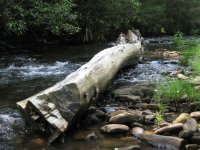
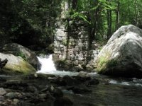
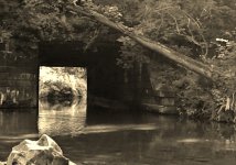
osprey - I know exactly where you are talking about. I've run across them while hiking with my family a few years ago and notice them when I fish up through there too. In the same area is an old concrete structure on the stream. Unfortunately, I don't know what the foundations used to support. That area was certainly mined but the pit and the forge were upstream from there. An interesting side-note about a historical "artifact" nearby that stream is the huge pile of iron furnace slag that is piled by the stream. It has been noted that the stream has an acidification problem, and while it's purely anecdotal, I've observed a higher concentration of fish in the stretch directly downstream from the slag pile. Since limestone was one of the raw materials used as flux to remove impurities from the iron ore, the resulting slag contributes a basic solution to the stream, and I had a wild conjecture that in that section, it helps neutralize the acid, which in turns supports a better fish population.

Sandfly - are those photos by William T Clarke? One of the neatest exhibits I saw was at the Pennsylvania State Museum, I think in 2011. It was of a number of his photographs of old logging camps and activities. If they ever published a book of his photographs, it would definitely end up in my library.

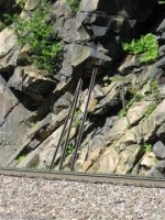
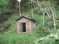
wildtrout2 - I definitely recognize the spring house/explosives storage house/whatever-it-is. I have a photo of it somewhere, but I believe it may be from my 35mm camera days. On the pipelines, I believe many of them are natural gas. The ANF is littered with them.

Skip16510 - seems the other old dynamite factory that I know of went boom. There's one located near me in Shenk's Ferry. Blowing up might be the ultimate fate for most dynamite factories..

Unfortunately, the photos I do have are but a fraction of the stuff I've found over the years. Like many others, there are things that I've found that I wish I had taken pictures of, and most of the time, it was because I was in too much of a hurry to stop and pull out the camera or phone and snap a shot. I definitely have taken more historical photos in recent years, so maybe I've turned a corner. I still have to go through my 35mm prints; I didn't start taking digital photos until about 2004.
 
Old pump house on the headwaters of Baldwin Branch. Pretty much in the middle of nowhere these days.
 
Not really part of history, but I saw this after fishing a creek in (Lancaster I think) a few years back. I thought it was pretty cool.
 

Attachments

  • MotoTinMan.jpg
    MotoTinMan.jpg
    27.9 KB · Views: 3
osprey wrote:
the stretch between the two lakes runs towards the south as you fish your way upstream , about halfway up there are numerous old foundations , very industrial looking , modern looking not really that old looking ,

It's super secret military and I could tell you but, as the old saying goes....I'd have to kill you. :-D

Anyway, kidding aside, I think what you're describing is the ruins of old Camp Sharpe. This was established during WWII on the old Pine Grove Furnace CCC camp. It really was super secret at the time. There were Axis prisoners kept there for interrogation.
There was a rather large German POW camp here in Gettysburg just a few yards from where I'm typing this. The prisoners here in G-burg were mainly Wehrmacht guys from the Africa Korps. According to old time local folks, the camp up in Michaux was for hard core SS types and it's even rumored that there were Japanese prisoners there too. Local legend around here also claims that the D-Day maps for France were drafted at this site.
 
Many of the trails along trout streams in State Forests are actually old RR beds, and on many you can still see remnants of the ties. I've found old Splash Dams, including 2 on Kettle Creek, one at Splash Dam Hollow, one on Northkill, and dams and skid paths along many other streams.
There are remnants of an old RR along Slate Run, obvious at the Morris Run Rd. bridge. There's an old RR bed along Lower Ltl. Swatara Creek. I haven't been there yet but there's a village on Hammersley Fork at the branches. The road going out of Leetonia due north is an old RR, it goes all the way to Tiadaughton on Pine Creek.
There all kinds of stuff out there, especially in the SF's. Most of it is overgrown, but much of it will remain for a very long time. Like the resort on Devils Hole, an old RR along Baker Run. Running right up the streambed of Hyner Run was a RR. Many of the forest roads were built on RR's.
Many old dam sites are still along streams, and there are a lot of places where streams were straighten or move to allow farming or logging operations to make 'better' use of the land. Streams were also move to make roads.
 
Back
Top