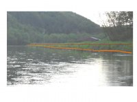
well those are conservation issues. If Riparian buffers are conservatiion.I haven't been on that stretch in a long time. From what I remember, it is difficult, because of the vegetation "management" and the man-made alterations to the bank.
Anyway, there is a term called "bank full" that indicated where the stream volume extends to during an approximate 1-2 year flood event. You know your basic gully washer. I would wager this to be your high water mark. The term is used extensively in the Natural Stream Channel Design circles, (not to derail the thread). But my understanding is that of Afish's explanation where if the stream is entrenched meaning there is a slope to the flood plain on the point bar edge (inside of a bend) no matter how gradual the bend is, then the Bank Full mark is typically about 50-80% up the bank depending on the lay of the land. There are all sorts of indicators like wetland plants, pebble size distribution, etc that definitively indicate the Bank full elevation.
My point is, The waters edge on a point bar is BY NO MEANS the high water mark in any stretch of the imagination. The position of those signs and the "enforcement" of them is bullying.
So I agree with Afish, walk about 2/3 of the way up the slope to the flood plain and you will be at the high water mark.


