Wild trout, Geology, & Bedrock. More info?

steveo27

steveo27

Member
Joined
Jun 4, 2014
Messages
919
The more I read about wild trout and predicting wild trout, the more I see geology has a lots to do with where youll find wild trout.

I would love to find some more info on how all of this works together - geology, bed rock, buffering, ect.
 
I'm a geologist, what exactly do you want to know?

Bedrock has a large factor on the alkalinity of a stream, which in turn has an impact on what and how much life it can support.
 
geology, acid rain/deposition, and trout:

http://swas.evsc.virginia.edu/publications/Current-and-Projected-Status.pdf

"1. The source of the acid: fossil fuels
The burning of fossil fuels releases sulfur and nitrogen
oxides into the atmosphere, where they are converted
to sulfuric and nitric acids. These acidic materials
may be transported long distances in the atmosphere
before they are deposited in wet or dry
form on landscapes.

2. Landscapes differ in sensitivity, based on geology.
Whether or not acidic deposition produces negative
effects on the animals living in streams and lakes
depends largely on the bedrock geology of their
catchments. In landscapes underlain by limestone
(carbonate bedrock), which provides substantial
buffering of acidity, negative effects due to acidification
are neither expected nor seen in water bodies.
Basaltic, granitic, and siliciclastic (such as sandstone)
bedrock types represent a series of decreasing
levels of buffering capacity, such that modest
amounts of acidic deposition produce conspicuous
negative effects in sandstone catchments.
Catchments composed of multiple bedrock types
naturally show intermediate degrees of sensitivity to
acidification, dependent on available local buffering
capacity. Since buffering capacity ultimately depends
on the weathering of acid-neutralizing material
from the bedrock, hard bedrock types produce
less buffering capacity for streams than soft bedrock
types. Mountains by their very nature are more resistant
to weathering than surrounding lowlands
(that’s why the mountains are still there), so mountain
streams and lakes are usually the most sensitive
to acidification due to the lower weathering rate and
buffering capacity of their catchments. In contrast,
large valley streams and lakes are the recipients of
upstream weathering products, and are often less
sensitive to acidification as the result of their greater
buffering capacity.
If the bedrock types underlying a given landscape
unit are a heterogeneous mixture in terms
of their acid-neutralizing capacity, there will be
different responses among the water bodies and
fish communities, even under identical acidic
deposition regimes.

3. The role of aluminum: metabolic poison
Aluminum is the most abundant metal on the
earth’s surface, and the third most abundant element.
It is non-toxic and insoluble under acid-neutral
conditions, but very toxic to fish and other
aquatic species under acidic conditions. Unfortunately,
the solubility of aluminum increases exponentially
as pH falls below 5.6; its maximum toxicity
occurs at about pH 5.0. The deposition of acids
results in the release of aluminum from soils and its
transport in solution to streams and lakes. Both the
aluminum and the hydrogen ion (derived from sulfuric
and nitric acids) are toxic to fish, but in most
streams and lakes the aluminum is the primary
lethal agent; fish can survive more acidic conditions
(i.e., lower pH) in the laboratory in the absence
of aluminum.

4. Site of toxic action: fish gill
The site of the toxic action of both the hydrogen
ion and aluminum is the fish gill. The gill is a complex
organ responsible for oxygen and carbon dioxide
exchange, as well as maintaining the proper salt
and water balance in the fish’s body. It is this latter
function which is always compromised by acid and
aluminum stress; respiration is also compromised at
higher concentrations of aluminum.
Freshwater fish maintain salt (sodium chloride)
in their blood at concentrations similar to those in
humans and most other vertebrates. The proper
functioning of most body cells, and especially blood
cells in this context, depends on keeping salt concentrations
in body fluids within rather narrow limits.
Since salt concentrations in the blood are much
higher than the water in which they swim, fish constantly
lose a small amount of sodium and chloride
from the blood by passive diffusion across the thin
skin of the gills. The lost sodium and chloride are
replaced by an energy-requiring process (active
transport) using biochemical “pumps” in the gill
membranes which transport sodium and chloride
from low concentration in the external stream water
to higher concentration in the blood.
Aluminum and hydrogen ions poison the biochemical
pumps which transport sodium and chloride
into the body; they also weaken the junctions
between gill cells, making them leak more sodium
and chloride than they otherwise would. The rapid
loss without replacement of sodium and chloride
produces a cascade of negative physiological effects
in the fish’s body."
 
Thanks K-bob, I knew I could count on you to post some info.

wjkosmer wrote:
I'm a geologist, what exactly do you want to know?

Bedrock has a large factor on the alkalinity of a stream, which in turn has an impact on what and how much life it can support.

Im just looking for articles to read. I understand how they all work together. I would just like to be more informed.
 
While not specifically fishing related, here is a good place to start for geologic information for PA http://dcnr.state.pa.us/topogeo/publications/pgspub/index.htm
 
nice article on the association between bedrocks and trout species

http://troutstreamdaydreams.blogspot.com/2016/05/geology-best-fertile-trout-stream.html
 
Thanks for the links dudes. Ill have to give em a read.
 
I am a geologist as well (obviously). I deal mainly with mine drainage and have experience with other various environmental impacts. Feel free to either ask on the forum or pm me.
 
Both myself and kbob and some others have written about this topic quite a bit on posts here on paflyfish.

You might try using the search tool to find these.

But, what are your goals? Are you mainly interested in finding good fishing? Or is it more a curiosity about the science?

And is there a particular region you are interested in? Because PA is a big state. And the geologic layers are different in different places.

I've dug into this topic quite a lot over the years and find it very interesting.

But here are a few caveats:

It's really not that easy to predict accurately what the fishing will be like based on looking at geology maps, for many reasons.

The geology of PA is very complex.

The geology maps are not super accurate, they can be off in places.

The geologic layers are not uniform, so the same is true of the buffering and fertility they provide.

The basic method that most people are going with is: Learn which layers are infertile and which are fertile. Then look at the geology maps and fish where the geology is fertile, and avoid the areas where the geology is infertile.

But, that could cause you to miss a lot of very good brook trout fishing. There is some very good brook trout fishing in the infertile areas.

In these infertile areas, the upper ends of the creek often have no trout or any other kind of fish.

Then further down, the brook trout appear. And there can be brook trout for quite a ways downstream, often without any competition from brown trout.


Its more of a curiosity about the science behind it and how everything works together. I would just like a better understanding, especially in my half of the state.
 
Probably the best way to start is to read books on PA geology.

You can search out the titles online, then request them at your local library. If they don't have them, they can get them via inter-library loan, at no cost to you.

But if you mostly interested in finding wild trout streams to fish in your region, I suggest getting the maps for public forest lands, such state forests, large state parks, state gamelands, and Allegheny National Forest, in your region.

Then start looking at the PFBC wild trout streams list. And just start fishing them. On infertile streams, as you explore and fish your way upstream, at some point you may "run out of fish", i.e. you've got up the upper part of the stream that is too infertile to support trout.

But the fishing can still be good further down on these streams. There are lots of other factors involved too. Physical habitat (pools and cover) plays a big role.
 
As you start your research, keep in mind that especially in western PA, a fair amount of the formal geologic formations you will read about are very thick and cover a vast array of bedrock types (ie sandstone, shale, coal, limestone, etc). Each bedrock type is unique in its properties. The formations are also generalizations to some extent.

For any number of reasons (fault, channel cut, etc) a particular layer of bedrock may not exist in a location. The bedrock you expect to find at a particular location may not be there at all.

Obviously there is much more to it than that. But those are some basic things to keep in mind.

Happy exploring. And once again, anyone can feel free to pm me or ask a question on the forum. I'll do the best I can to answer them.

 
You can have the best geology for trout in the world, but even that can be trumped by lack of on stream vegetation or enhanced by vegetation.
 
links related to brookies in laurel hill swpa linked below...

as others have noted, a stream needs water temps and can't dry out in order to have trout. habitat -- pools and cover -- of course explain the potential for # and size trout once the temps are suitable. fertility and food (such as overhanging plants for terrestrials in infertile streams) are critical, etc..

geology is only one variable, but it is one variable that, in combination with acid deposition, can lead to no trout all in PA headwaters streams... simple bedrock maps are a useful and available proxy for buffering, but not the whole story as PAGeologist notes above... geology is much more relevant to high headwaters not lower valleys (post 3 above: "mountain
streams and lakes are usually the most sensitive
to acidification due to the lower weathering rate and
buffering capacity of their catchments.")

in western/swpa, headwaters streams in pottsville bedrock may have worse acidification problems than pocono bedrock ones. I read somewhere that some of the mauch chunk bedrock in swpa has some limestone in it

since there are laurel hill headwaters streams in pottsville, burgoon, mauch chunk, and other bedrocks... if I could find one one public land that is mauch chunk influenced, I'd give it a shot, after using maps, books, and the state lists, etc. as TB notes.

1) can get geology map with tab at upper right

http://www.gis.dcnr.state.pa.us/maps/index.html

2) laurel hill study:

"ABSTRACT: A survey of 61 headwater streams and their watersheds on Pennsylvania's Laurel Hill, an area of high hydrogen ion and sulfate deposition, was conducted in May and June 1983. Trout were absent from 12 or 20 percent of the streams. No fish were present in 10 streams. Thirty-three streams appeared to contain viable trout populations, 10 streams had other interferring cultural impacts and 6 streams had nonviable trout populations. Significant differences in water quality were noted among streams with and without fish. The streams having no fish as a group had significantly lower pH and alkalinity and higher dissolved aluminum than those with fish. Attempts were made to correlate soil type and geology with the presence or absence of trout. Watersheds with a major percentage of very stony land soil classifications always contained no trout or were culturally impacted. On the other hand, watersheds with a major percentage of Upshur (limestone derived) soils always supported trout. Watersheds with more than 30 percent Pocono Group bedrock supported trout in every case but two, while in every case but one, watersheds with more than 30 percent Pottsville Group bedrock did not support trout. Acid runoff episode data indicate severe transient acidification attributable to atmospheric deposition. It appears that a combination of very stony land, 30 percent Pottsville Group bedrock and high deposition of hydrogen ions and sulfate may result in transient acidification and absence of fish populations from headwater streams on Pennsylvania's Laurel Hill."

3) mauch chunk in swpa:

"Limestone caves in the Laurel Highlands Region are associated with the 320-345 million-year-old Mauch Chunk bedrock formation. Caves occur locally in the limestone dominated Loyalhanna and Greenbrier members of the Mauch Chunk formation."

http://waterlandlife.org/250/the-laurel-highlands

4) burgoon: "The general pattern observed for the watershed is that higher degrees of acidification tend to correlate with higher elevations, corresponding to the Burgoon Sandstone." (this from a study of headwaters streams w/ no trout due to acid in NEPA)

http://www.wehydro.com/images/2007fc.pdf

5) pottsville bedrock, from pfbc:

"Kocovsky and Carline (2006) noted that streams with underlying Pottsville sandstone geology were the most problematic in retaining wild trout populations. This was due to the lack of buffering capacity from previous acidic episodes, the leaching of acidic materials, and the leaching of aluminum during precipitation events."
 
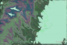
two marked laurel highlands streams... pink = mauch chunk bedrock; blue = burgoon; transparent lime greens = pottsville & alleghany...

both streams are on the state nat repro list. but if the drainage area, access, etc., seemed similar, I'd try stream #1 first, because more of it flows through mauch chunk. stream #2 has burgoon headwaters and alleghany and pottsville at lower levels, less mauch influence.
 

Attachments

  • eer.jpg
    eer.jpg
    115.1 KB · Views: 12
The stream above stream number #2 and to the right of the golf course has a lot of burgoon headwaters.... those headwaters might not be so good for trout.
 
a few more thoughts on streams in map post 15.... if the only place I could access stream #1 was in the section at the bottom of the map, which is in low-buffering pottsville bedrock (transparent green), I think it would be fine due to the higher buffering mauch chunk sections above. so the issue is not the bedrock you are in, it is whether the water has been buffered upstream of you.

also stream #2, with the (blue) burgoon headwaters above a mauch chunk stretch, might be the kind of stream TB mentioned where as you fish upstream, you see fewer fish, and maybe even run out of them at higher elevation...
 
Gotcha.

K-bob, thats the exact kinda stuff Im interested in - how different types of bed rock affect trout/waters in certain areas.

I recognize the streams in the map you posted. Ive fished stream #1 with some good luck. The trib to that stream that is Pottsville only does not fish well at all though, and now I can see why.
 
forgot to say that streams might be surveyed at lower levels but appear on a state trout list as "headwaters to mouth" and drawn that way on maps...

I might not be optimistic about trout in the headwaters of that stream above stream #2 & to the right of the golf course given the burgoon bedrock
 
Hi steveo27.. I have never made it over there! Maybe some day. Have always liked the way it looks on maps
 
Back
Top