Bamboozle
Well-known member
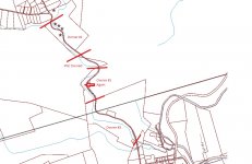
First of all, Google Maps are far from accurate.
To be 100% sure you would have to look at the property parcel map on the Schuylkill County Website to see who owns what and where the actual dividing line is.
You can also look at the SGL 222 map on PA Game Commission website which SHOULD be accurate but could be a few feet off. That map shows only a short section that is 100% within the SGL 222 boundaries on both sides of the stream.
Bottom line, if the dividing lines are in the middle or edges of the stream. It is hard to fish without technically trespassing.