Brook Trout population before things were destroyed.

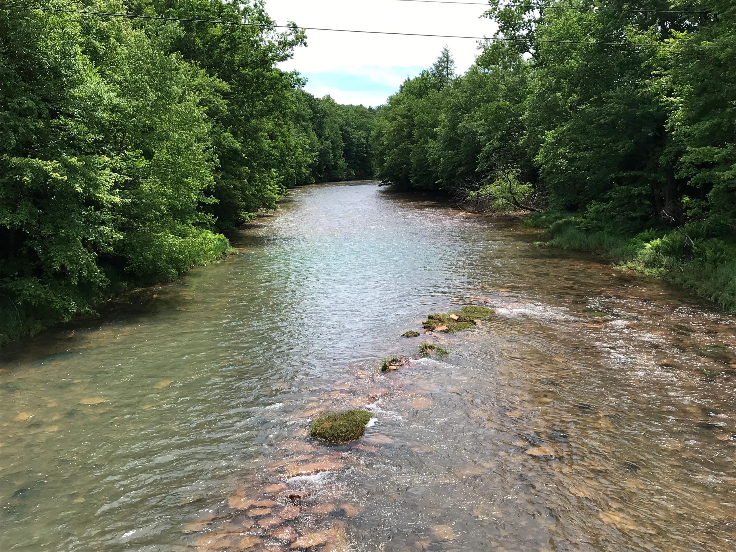
I'm talking about Red Mo (Moshannon Creek.) I've backpacked the AFT numerous times and I'm always amazed at the beauty of the trail running along Moshannon Creek.

I know Moshannon is super dead. That's why it could be a candidate. Kill the tribs with brownies and try to make it a dominant brookie stream. No doubt browns would eventually show up, though. But above the pollution, Moshannon is filled with Brookes, right? The headwaters.

At certain times of the year it can find a bunch of Brookes in Black Mo. If the lake/dam wasn't there that stream would have some potential. The lake warms it too much. That's why I never understood the DHALO area just below the dam.
a group, quite active, has taken on restoring the previously neglected AMD treatment facilities on Red Mo.
they also have a FB page https://www.facebook.com/MoshannonCreekWatershedAssociation/

things are looking up for the future of red Mo
 
That’s correct, but doesn’t negate Salmonid’s specific comments about ST. It is possible that the larger streams in question were warm enough at least in their lower ends to support SMB had they been introduced prior to the vast amount of logging that took place. How warm these streams really were in the pre-logging days could be implied if some of the books written about ST in northcentral Pa also happened to mention other species that were caught as by-catch. Do they?

To somewhat illustrate my point, here’s an example from SE Pa, specifically the headwaters region of the Schuylkill R. The Schuylkill R proper almost certainly supported a ST population and even today supports a diminished population close to Port Carbon, located immediately upstream from Pottsville (The very headwaters support a good population).. The historical record describes the upper geographical limits of American shad, striped bass, and white perch movements or catches as being Port Carbon. These species temperature preferences certainly differ from the temperature preferences of ST, which suggests to me that longitudinally the Schuylkill may have started to seasonally warm beyond the temp preferences of ST upon reaching the Port Carbon area or that the sparse leading edge of these migratory fish populations pushed upstream as far as Port Carbon into water temps that allowed some overlap throughout the year just like striped bass (limited numbers), BT and RT overlap in a portion of the upper Delaware. Knowing how fish species populations transition longitudinally…usually somewhat gradually without human influence on water temps… the historical comments do not suggest to me that there was absolutely no overlap among the migratory species and residents (ST) in Port Carbon, at least on a seasonal basis. It only suggests to me that Port Carbon may have been geographically close to the point where ST populations dropped off substantially in a downstream direction absent additional cooling from tribs, such as the West Branch. The point here is that with some sense of species composition or mix, one can derive a better sense of what may have been true and what may have been angling lore.


So, you readers of all things brook trout and/or Pa angling history, do any authors shed light on other species that were present in these larger northcentral Pa streams that individuals associate with larger ST of the past, such as the Loyalsock, Pine, or Kettle? If so, are the geographical locations mentioned or implied along with the species that are mentioned?
I will add that every tributary of the Schuylkill River that I have fish, and there are many, still hold fishable populations of Brook Trout. I won’t reveal where I fish. But most are larger than what’s found in more northern streams.
The book by Phillip Thomb”Thirty Years Hunter” talks of catching 5 pound trout in Pine Creek during early summer below Slate Run. He move to the area before 1800.
 
Thanks for the responses Chaz and SandFly! This is a ,not above Galeton, late May, Big Pine Brookie from last spring. Caught May 20th so she was hanging in there right till the water was too warm. Not quite early summer, but close. There were a few Green Drakes hatching and of course I didn’t have any on me. But a big March brown worked for her on the third drift.
IMG 5395
 
Thanks for the responses Chaz and SandFly! This is a ,not above Galeton, late May, Big Pine Brookie from last spring. Caught May 20th so she was hanging in there right till the water was too warm. Not quite early summer, but close. There were a few Green Drakes hatching and of course I didn’t have any on me. But a big March brown worked for her on the third drift. View attachment 1641233911
How long is that fish? 8 inches?
 
When I mentioned above galeton it was in reference to pine creek being 10 to 15 feet wide. Now I get that many of our streams are wider than they historically may have been, but there is no way given the size of of the watershed that pine creek was 10 to 15 ft wide below Galeton when you add in West Branch.
 
When I mentioned above galeton it was in reference to pine creek being 10 to 15 feet wide. Now I get that many of our streams are wider than they historically may have been, but there is no way given the size of of the watershed that pine creek was 10 to 15 ft wide below Galeton when you add in West Branch.

I remember a guy saying that the Susquehanna River near Harrisburg was about half its current width back in the day, but didn't offer anything to support that.

So maybe there is a general idea floating around that streams and rivers are now far wider than they used to be. But is that true?

What say you all? Do you think streams and rivers are on average, wider, narrower, or about the same width?

If wider or shallower, by what percentage?

It's not just an interesting question, but also an important question for stream restoration. To restore streams it would be good to have some idea what they were like originally.

Generally, the same.

I think there are sections of streams and rivers that are now artificially wider and slower due to legacy channelization and added sediment from logging and impoundments, but in general, the same.

I’m sure they built all those old railroad bridges across the Susky in/around Harrisburg 120+ years ago twice as long as they needed to be in anticipation of the widening. 🙄 Guy was spinning yarns.
 
Last edited:
It's a mix across the board. There are some streams that are incredibly incised due to floodplain encroachments that may be much narrower than historical conditions. Others, I'll throw out examples of Lycoming Creek, Kettle below cross fork, loyalsock creek, lower Fishing Creek that are very shallow and over widened in many locations.

It's complex due to unknown natural base hydrology conditions prior to mass clear cutting, land alterations and groundwater extraction.

I also think many of our 2nd order and larger streams would have had low bank heights with complex channel forms and more frequently engaged the floodplain.

Even so, I'm not buying pine creek having a 10-15 foot wide channel ever below Galeton.
 
pine was a brookie stream before logging. the Susquehannock natives spear them all year. pine at one time ran around 10-15 feet wide with hemlocks and pines covering it. native Americans called it dark waters always like twilight under the canopy. big meadows were one of a few places where there were no trees. my plce sits on a huge incampment for the Susquehannock .
Also what is the source of spearing brook trout all year long? Everything I've read it was shad in the spring that they speared.

If you look at photos of Pine during the logging days it's hard to believe that it was only 10-15 feet wide before they logged.
 
I’m sure they built all those old railroad bridges across the Susky in/around Harrisburg 120+ years ago twice as long as they needed to be in anticipation of the widening. 🙄
😂
And don’t leave out the covered bridge at Columbia-Wrightsville that was burned during the civil war to stop the advancement of Confederate troops. The supports/piers still stand.
 
Last edited:
I used to visit my relatives in the Catskills when I was a kid in the 60's and I never saw spearing trout, but sure did see trout "tickling." Scare the trout under rocks, then feel under the rocks to grab them.

BTW, when my father was a kid in 30's they used to gill net trout in the Brodhead by putting chicken wire across the riffles and have the kids run around the riffles to chase the trout into the chicken wire. That was to provide the fish for trout night at a resort he stayed at. He had fond memories of doing that. In the Michigan logging boom they netted grayling to feed the logging camps. Of course now they are extinct. I'm sure that was common many places. Even more recently over in NJ some guys netted brookies to serve the NYC restaurant business. One of the engineers I worked with in Illinois was a Chippewa from Wisconsin and he speared some huge walleye both under the ice using a spearing decoy and at night during the spawning runs.

Hungry/greedy people the world over have figured out easy ways to get a fish dinner or two.
 
Just imagine the populations of brook trout in Labrador/ Newfoundland. Just google earth that region and it’s littered with ponds, lakes and streams every 20 feet….. vast majority have not been visited
 
Just imagine the populations of brook trout in Labrador/ Newfoundland. Just google earth that region and it’s littered with ponds, lakes and streams every 20 feet….. vast majority have not been visited
If you haven't watched this video from Tight Loops yet, I highly recommend it.
 
😂
And don’t leave out the covered bridge at Columbia-Wrightsville that was burned during the civil war to stop the advancement of Confederate troops. The supports/piers still stand.
I live 3 miles from Wrightsville, and you can still see the ferry ponds, since they stopped dredging them years and years ago, they are nothing more then stagnate bullfrog pools, but are still there, so im defiantly not buying that the river was 1/2 as wide as it is now. Also as a side note, we still have the anniversary burning of the bridge, so its a cool throw back to honor the history of what happened.
 
In regards to the Catawissa, I know there is a good amount of work being done to remediate the AMD. Not saying that it would be possible to do what is stated, but it couldn’t hurt to reach out the the conservation district watershed specialists in Schuylkill and Columbia. They’re all great great people and are doing a lot for a bunch of watersheds in their respective counties. Just figured I’d add that in here. They usually have a pretty good pulse of what is going on in the county. Definitely couldn’t hurt to put a bug in their ears
 
spearing suckers in spring used to be a big thing in trout streams
 
Back
Top