k-bob wrote:
nice roadworthy pa bedrock geology megamaps sometimes $30-$40 on ebay.
https://www.ebay.com/itm/Geological-Maps-PENNSYLVANIA-VERY-LARGE-FULL-COLOR-41-X-59-from-1960-LOOK/164086480322?hash=item263450fdc2:g:m44AAOSw0lhdd-ei
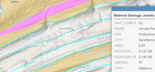
these maps are easier to use in NEPA & SWPA, parts NCPA, because there are bigger bands of bedrock. much tougher in center of state, esp. south central PA, where the bedrock bands are chaotic (see ebay images). I only know some of the better and worse bedrocks for trout, but in NEPA they help.
in laurel hill, SWPA, avoid pottsville, allegheny, burgoon, look for blue lines streams draining more pocono, or better still, mauch chunk.
in NEPA., huntley and mauch are good, catskill can be the cat's meow.
(post 17: "USGS, sullivan county, median well water ph: Burgoon Sandstone 5.9; Mauch Chunk 6.6; Catskill 6.9, Huntley Mountain 7.0."... log scale, so 6 is 2x acid vs 7)
https://pubs.usgs.gov/sir/2013/5085/support/sir2013-5085.pdf
supergeeky questions: anyone know if the 1960 versus 1980 printings of this map on ebay have the same info? any thoughts on onX maps versus garmin huntview for a handheld gps? I am upgrading, broke the ole etrex 30, will upgrade map from 1:24K topo w/o birdseye/satellite images as well. thanks.
some ideas on using bedrock to fish central PA here, for ex ph of 5 (ouch) in tuscarora bedrock streams:
http://www.departments.bucknell.edu/biology/courses/core/biol208/labs/CKirbyEtAl2008AcidPrecip.pdf