Trout Unlimited Brook Trout Atlas

sixfootfenwick

sixfootfenwick

Well-known member
Joined
Sep 17, 2022
Messages
1,179
Location
Pennsylvania
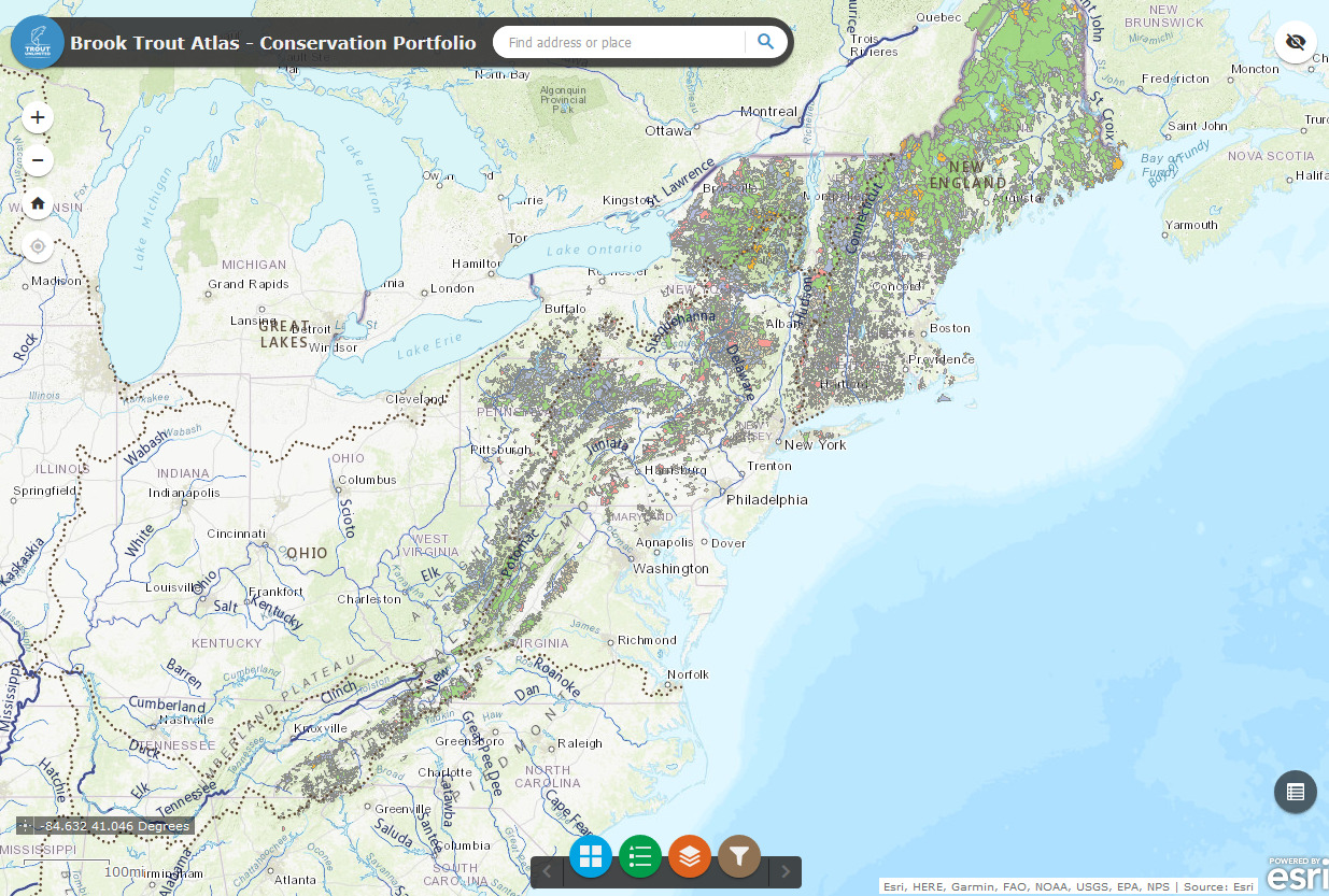
This is a neat link with a ton of info on the maps but I question how accurate it is.
Has anyone else seen this?

 
After ten minutes or so of playing with this, I can say with 100% certainty that I don't know how to use it.
 
What do they mean by "redundant?"

And what do they mean by "unique life history?"

Also, I did not see individual streams or stream stretches coded for brook trout presence. It looks like they are showing areas instead.
 
After ten minutes or so of playing with this, I can say with 100% certainty that I don't know how to use it.
Me either but I noticed on some brook trout streams in my area, they are listed as no presence 🤷
 
Me either but I noticed on some brook trout streams in my area, they are listed as no presence 🤷
Yeah....

I also noticed an area mislabeled with the wrong creek/watershed name. In the case I noticed it's hard to determine if the area was misplaced on the map or the area was marked with the wrong name. In the case I noticed the creek(s) in question are separated by a ridge. Additonally, confusing is that the area that is defined is over a creek that is locally known to contain trout, but the stream name used is for the neighboring creek which the PAFBC had once proposed as natural reproduction list addition.

Overall, the terminology used on this map, how the info was gathered, and potential accuracy issues create more questions than answers.

Still, it's kinda interesting and I'm sure it will help someone will discover a local brookie stream that they hadn't known existed.
 
A lot of the data represented in the map was algorithmically generated based on GIS data like %Forest Cover, % Land Use, and some biological data supplied by state and federal agencies. The classifications of priority are based on similar calculations.

I've argued for a while that this is dangerous because there may be life histories that we aren't privy to that may be far more important than what the algorithm decided. I'm not a fan of letting GIS math dictate the fate or importance of animals.

TLDR: Not very accurate and arguably dangerous.
 
What do they mean by "redundant?"

And what do they mean by "unique life history?"

Also, I did not see individual streams or stream stretches coded for brook trout presence. It looks like they are showing areas instead.
That's what I mean by "dangerous." Redundant essentially means that there are other populations that match the "profile" of that population and conservation efforts should be focused on other pops.

Unique life history = lacustrine, groundwater stream, metapopulation, or some other profile features that the software determined were more important than your run-of-the-mill mountain freestone dwelling population.
 
Yeah....

I also noticed an area mislabeled with the wrong creek/watershed name. In the case I noticed it's hard to determine if the area was misplaced on the map or the area was marked with the wrong name. In the case I noticed the creek(s) in question are separated by a ridge. Additonally, confusing is that the area that is defined is over a creek that is locally known to contain trout, but the stream name used is for the neighboring creek which the PAFBC had once proposed as natural reproduction list addition.

Overall, the terminology used on this map, how the info was gathered, and potential accuracy issues create more questions than answers.

Still, it's kinda interesting and I'm sure it will help someone will discover a local brookie stream that they hadn't known existed.

I was using it to look at small Lake George tribs up here in NY where I do a lot of brook trout fishing. Some of the area divisions grouped both sides of the lake in 1 unit. So, these drainages are basically separated by a mile of water on a lake that's 32 miles long. It maybe makes sense that AI or whatever would see these as geographically similar, as silverfox mentions, but I can't see how anyone on the ground would group together 2 small streams that, practically speaking, are 50 miles apart by land.
 
Last edited:
Back
Top