pcray1231 wrote:
Troutbert,
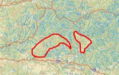
I don't know of a single tributary to the Tionesta which is NOT on the natural repro list. Upwards of 40, at least. The natural repro list is not a great tool in this area. Almost all streams have a handful of wilds in their upper ends. But there's a big difference between low class D and a respectable wild stream. There's also a big difference between having fish way upstream and having them inhabit the lower areas.
As RLeeP said, the Clarion drainage is the weak stepsister in the area. That doesn't mean there's no wild trout fishing. It also doesn't mean there's no good fishing. And, simply on account of being bigger water, the upper Clarion itself has an earned reputation for big fish. It's merely weak in comparison, as in % of water in the system that is good for wild trout. The Tionesta drainage is even borderline. It has plenty of smallish, infertile brookie streams, especially from the north. The streams are cold with good structure. But in terms of water chemistry and fertility, it doesn't hold a candle to the waters to it's W and NW. Direct Allegheny tribs like the Hemlock system, even Sandy, East Hickory, etc. Oil Creek drainage, Brokenstraw drainage, French Creek drainage. Those streams are much, much richer than the Tionesta system.
Though, as was said, water chem is only part of the equation. Those richer streams to the west and NW are in flatter country, and while water chemistry is better, structure and temperature can be worse. French Creek, for instance, is ridiculously fertile, semi-limestoner fertile, and it translates to good fishing. Just not always for trout. Parts of the Brokenstraw system fit that description as well, and parts of the Oil Creek drainage are very fertile as well.
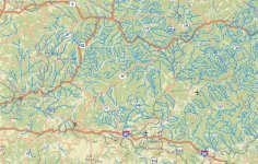
Salmonoid, thanks for the maps. When I get a chance I'll pour over them a bit. I've had that idea as well. The maps can be difficult to find and it requires some work that I simply haven't got around to doing. I too am convinced geology plays a huge role. Sorting it all out is complicated, tedious, and time consuming, and to my knowledge noone has really given it a go for the purpose of enabling fishermen.