nymphingmaniac
Well-known member
Hate to pull the scab off so soon...but
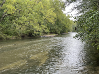
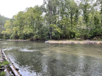
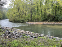
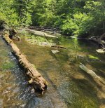
I just walked along Spring creek at Benner Springs. There is a large number- 30+ ? hemlock logs and an excavator at the far parking lot. I think they are extending the project to narrow the channel. BS is the warmest and most overgrown section of spring creek.
I just walked along Spring creek at Benner Springs. There is a large number- 30+ ? hemlock logs and an excavator at the far parking lot. I think they are extending the project to narrow the channel. BS is the warmest and most overgrown section of spring creek.
")