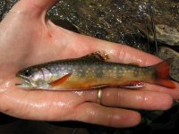
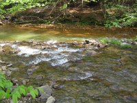
If you grew up in the area, you're probably aware of the coal mining in the region, and naturally, the acid mine drainage that it leaves behind. If I recall correctly, from a few years ago while backpacking the Elk Trail, which I believe follows Trout Run into Benezette, there are mines in the headwaters of that stream. The stream looked ok down towards Benezette but I'm sure it's impaired in some places the further upstream you get. So a tool that you mind find useful is a pH meter, to test the acidity of the streams. Some of them are obviously impaired - the one photo shows Bell's Branch as it flows into Dents Run. Bell's is unimpaired; Dents at that point is loaded with yellow boy. It was one of those moments that struck me, because there was a pretty clear interface between polluted/unpolluted, and the brookie I caught was pretty much guaranteed to have been spawned and grew up in Bells' Branch. Other streams may look fine, because the AMD has been diluted somewhat by the time you get downstream a bit, but their aquatic life is fairly limited.
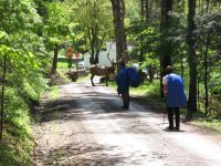
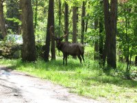
The elk are on Trout Run road, as it comes into Benezette - a fitting ending to a hike on the Elk Trail. There was a second smaller bul that wandered down behind the big guy.