Topo Maps and Devices

AugustWest

AugustWest

Member
Joined
Sep 11, 2006
Messages
143
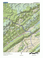
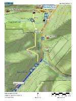
Need some help here - I am looking for topo map assistance. I have read about the Garmin GPSMap64 which takes an SD card, but I am wide open to suggestions regarding topo maps online or on a device, USGS maps online or on a device.

I think I want something I can look at (and print out?) on my home computer, but I am open to suggestions. I do a lot of backwoods exploring and have a BackTracker so I don't get lost, but I would like topo as well.

My home computing is on a MAC.

Any help would be appreciated as I am just starting my research. Thanks.

"May the four winds blow you safely home."
 
Not exactly what you were looking for, but if you happen to have an iphone there is an app called TopoMaps that I really like. I'm sure it's available for other platforms as well...
 
There are sites that you can either purchase specific quads and print them, or have them mailed to you. You can also pay a yearly access fee and print off as many as you'd like.
 
there are no free USGS maps online - hard to believe, but its always been that way. i was told that it was so as not to assist our enemies - the same way google maps blurs out power stations....

trails.com if you sign up and pay will also let you print quadrants, but thats the nearest i found. my Garmin eTrex I keep as back up to the compass and iphone compass.

given the wide range of watersheds i fish, i find it better to use state park maps, google maps (terrain option) and bing maps for the 45 degree function to get an idea of terrain, geology, access and way points.

i find with all of the above, i get some good clues about new water.

i also never go in without a firestarter knife, emergency blanket and flashlight.

cheers

Mark.
 
Free USGS maps can be viewed at AcmeMapper.
http://mapper.acme.com/

Click on Topo on the far upper right. You can also switch to regular road maps, and to satellite view.
 
delorme has topo and street map disk you can buy, have them on all my computers. heres a sample and one I made using the program.
 

Attachments

  • wallace run.gif
    wallace run.gif
    85.3 KB · Views: 3
  • darling run (300x400).jpg
    darling run (300x400).jpg
    77.5 KB · Views: 4
I have the garmin map 64 and like it. Came preloaded with topo for north America and you can download their software for your computer for printing and creating routes/waypoints. I also added the Hunt PA topo SD card which shows property boundries/owners. It isn't totally accurate, but it is pretty good. I like it cause if I'm hunting or fishing you can see easily if you moved off of public land (also gives land owner info). For printed topo or creating custom topo I use mytopo.com (they are out of Montana) and I like their maps. Easy to build and order online
 
FREE usgs maps for PA can be downloaded here:
www.pasda.psu.edu

I suggest the USGS GeoPDF version of the USGS Quadrangles. They are more up to date and layers can be turned on/off via Adobe Acrobat. They even include the aerial imagery in the background on these.

 
No free USGS maps online??

http://viewer.nationalmap.gov/viewer/

Android app: Oruxmaps, will cache whatever you view for later offline use (plus a whole suite of tools you can use on your PC to create offline maps - may work on a Mac too).

iOS app: Galileo - will allow you to create and store maps on your iDevice for offline use.
 
Arc GIS Online or Google Earth...use a program like Snagit or a clipping tool. You can then save the image as a jpeg. Maybe not the best way but it should work.

"god save the child who rings that bell"
 
Garmin's are cool. But for fishing, I have the PA fishing app on my phone. It's like $30ish bucks, a little buggy, but you can flip between satellite and USGS quad map. The PA fish commission lists are overlayed.

For hunting, I use a dedicated handheld GPS, and the Garmin 64 is a good unit. For fishing, I have that unit for the more serious trips, but the phone version mentioned above is often more useful when researching at home, or when in the car switching to "plan B". The downfall of the phone based system is that, well, it's reliant on having a signal and fairly data intensive.

I haven't seen the latest versions, but for fine topo detail the Garmin licensed topo software left something to be desired. Tended to smooth out fairly major features. I wouldn't worry about that for fishing purposes, but for hunting, looking for draws and the like, it is sub-optimal. USGS rules....
 
https://play.google.com/store/apps/details?id=com.gogalpublishing.gpsfishingpa&hl=en

2nd screenshot shows you the topo functionality. Kinda gotta learn the color codes, though. For instance, the light red lines means it is not ATW, not special reg, not class A, etc., but IS on the natural reproduction list.
 
Electronic USGS maps are free. I would check out the Penn State PASDA site for specific quads. In addition the USGS now distributes quad maps as PDF files.

You can still order paper maps. Most are $9.00.

USGS MAP STORE

Garmin has a free mapping program called BASE CAMP. If you own an Oregon or Montana model you can download USGS topo maps directly to your GPS via subscribing to a yearly service ($30). Once the maps are downloaded they are yours. They have bing mapping for download as well.

I work as an engineer and surveyor. If you have any additional questions send me a PM and I can assist you further.
 
http://www.pgc.state.pa.us/portal/server.pt/community/pgc/9106

Click on "State Game Lands Mapping Center"
Click on "PGC Mapping Center"

The entire State of PA is covered.

Click on the "Basemap" icon and you basically have 3 map options:
"Topographic"
"USGS Topo"
"Imagery"

When I get the map I want, I do a "Print Preview" and then Shrink to Fit 70%, this flattens out the map and makes a good print. This is easier than using the PGC map-maker feature, which takes a long time to load. I fit these disposable maps into plastic sleeves and carry them in the field all the time. Very handy.
 
here's a nice map that can display the roads opened for hunting season in PA state forests:

http://maps.dcnr.pa.gov/bof/huntmap/index.html

(need a fast connection. click "map layers on/off" box upper right, check box on bottom of screen to display roads opened for deer season. zoom in and click displayed roads for opening schedule.)
 
Lots of great suggestions! Thanks guys.
 
Back
Top