Rainfall from Isaias

afishinado

afishinado

Moderator
Staff member
Joined
Sep 11, 2006
Messages
16,233
Location
Chester County, PA
A real drought busting gully washer expected for eastern PA, maybe too much all at once.

Too bad it won't help the central or western part of the state.

(Click chart to zoom in)
 

Attachments

  • Rainfall Tropical Storm.jpg
    Rainfall Tropical Storm.jpg
    144.7 KB · Views: 12
It is a shame, because NE has been getting all of the T-storms over and over, but the NC has gotten next to nothing this summer.

I don't see Pocono streams being fishable for quite a while after tomorrow. That Lehigh will be ripping!
 
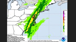
WT2: Not NE. From Stroudsburg, southwest through SCPA "-burgs" have gotten WAY more rain that NEPA. Lackawanna, Delaware, and North branch Susquehanna are quite low and could use a lot of volume. Check out the color map to the right. Nearly all the blue and black dots are outside NEPA.

I don't think the north branch will get much help upstream from Pittston, but the Lackawanna will certainly spike hard due to urban runoff....then crash back down.

Also, I've been watering my veggy garden WAY, WAY too much. I would love some help from above.
 
I should have just said the Pocono region, upper NE is in need of some precipitation. I'm curious to see what all the rain will do with stream temps.
 
Biked past the Lehigh just north of Allentown today. It is a little high, rolling along at a very fast pace, and fairly turbid, but not so much so that muddy colored Coplay Ck did not add to the turbidity. Coplay is high, but not nearly bank full. It won’t take much to send it to the tops and over its banks though and the Lehigh is primed to potentially cause problems.
 
I live in the western part of the state, and spend alot of time in the central part. I quit carrying a rod with me on my travels, the streams are just too low, and too warm. I just don't feel like fishing when it's like this. be nice if this storm turned a little west and spread some water this way!
 
I think we are supposed to get nearly the perfect amount where I live. 1-1.5 inches or so..enough for a good drink but hopefully not enough all at once to flood or cause damage.
 
There seems to be good rainfall for NE and NC PA. Towanda through Williamsport have 1/2 - 3/4" so far. Pike, southern Wayne, Lackawanna counties are over an inch so far. It seems we will get at least another inch in the Scranton - Wilkes Barre area by 5 PM.

Unfortunately, SEPA is getting pounded with rain they do not need.
 
Nearly 2" in my backyard gauge here in Adams Co. and still steady and light. It came down mostly at night during cold temps in the 60s.

As usual, SEPA gets blown but this is good for much of PA.

 
Sitting here, electric is out. Sweet rain steadily falling. If I had a porch I’d be sleeping on it. Medium rate, Sinking in. Nice.
Made me think about a house about 15 blocks away where the split Bamboo rod was perfected. Here is some history: https://www.thehistoriceastoncemetery.org/samuel-phillippe
 
NC is dry, was out today the little rain that came down early today evaporated to quick. streams are drying up.
 
My Mothers power was out and I had a heck of a time even getting there; the Pickering and her tribs were way out of their banks we got 5.59" here and most of that between 8and 12 this am. Some scary wind as well.
 
The western Poconos pretty much unfishable according the gauges.
 
It's raining here right now with storms not associated with the main part of the hurricane/storm but we didn't get a whole lot here in central PA. I checked the rain gauge an hour ago (it's 7:30 now) and hadn't hit 3/4 inch yet. It didn't rain here at all over night. It is a much needed soaking. I checked some steam temps today too and fished for trout. I had decent fishing. I mostly fished a true limestone spring Creek and water was 58°. Other larger streams were cooled nicely by the rain and cooler temps.

It was much needed. No flooding, enough to make a difference, but we could some more..
 
Just checked the USGS gauge for the Little Lehigh; about 100 times higher than median flow when it peaked!
 
It would not surprise me if the Ltl Lehigh hatchery was flooded again. Have not heard that it was, but it would not surprise me based on what has happened in the past.

Also heard from a relative that they dropped Blue Marsh’s water level five ft or more ahead of the storm so that it could absorb and hold back the anticipated flood waters. The increased flow in the Tully DH area resulted in water temps of at least 78 deg F for about 48 hrs. based on the gauge.
 
That would be sad.
 
Has the storm knocked out USGS? no map.
 
Back
Top