J
Jelf
New member
- Joined
- May 15, 2012
- Messages
- 6
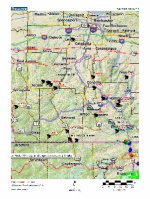
Most states, including PA, have detailed information on GIS (Geographical Information System) servers that can show the boundaries of various kinds of public land at the federal, state and local level. Government agencies also have other GIS data that is useful for all kinds of outdoor activities from hunting to 4-wheeling to horse riding to hiking to boating to fishing to biking and everything in between.
I have started a public service project to locate that GIS data and produce online maps so everyone has a super easy way to see and use that data. The types of GIS data that these online maps will display include:
1. Boundaries of public land
2. Recreation features such as picnic areas, campgrounds, boat launches, trailheads, etc
3. Trails
4. Fishing and hunting information
5. Habitats
6. Public safety including weather and wildland fires
7. And more....
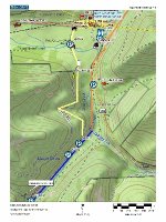
GIS data is displayed on the map as a symbol, a line or an area (polygon). If you click on GIS data then you will see a popup that shows all the information (attributes) that the GIS server has for the thing that you clicked. Sometimes the attribute data includes a link to even more information. This can be extremely useful to people that play outdoors.
So far I have completed online maps for 14 states including PA. The type of data that is available varies by state. I have also completed a number of national level online maps.
After a map opens, you can click "about this map" in the upper left corner to:
1. See the map legends
2. Learn how to turn other GIS layers on/off
3. Get other tips for using the map
Below is the homepage link for this project. Please take a moment to read through the text before you start playing with the map links. Also, if you want to get the most out of these maps, be sure to read the “Tips”.
Public land map homepage:
http://www.propertylinemaps.com/p/public_land_map.html
To see a good example of GIS attribute data:
1. Open the "USA Weather Map". This map shows all the current weather watches and warnings. This data is hosted on a GIS server operated by NOAA.
3. Click any colored area and soon a popup will appear. That popup shows all the GIS attribute data for the thing that you clicked. Note that one of the attributes is a link. If you follow that link then you will see the details for that weather watch or warning.
You can make an interesting map by looking at the GIS layer showing weather watches and warnings and then also turning on the layer that displays the weather radar.
All of these online maps are displayed by Gmap4 which is an enhanced Google map viewer that I developed. Using the same software to display all of this GIS data from coast-to-coast means you see a consistent interface based on the familiar Google maps and you also get the same broad feature set for every map.
Please keep in mind that Gmap4 does not attempt to process the attribute data. Instead, it simply displays the attribute data from the GIS server 'as is'. If some of that data is coded or looks like gibberish, don't blame me.
If you are GIS savvy, here is a list of GIS servers organized by state:
http://www.mappingsupport.com/p/gmap4_gis_more_help.html#source_state
Anyone that is willing to follow a few simple instructions can make their own custom Gmap4 map links to display the GIS data they wish to see.
For more information about Gmap4, please see:
Gmap4 homepage: http://www.mappingsupport.com/p/gmap4.html
Gmap4 default map: http://www.mappingsupport.com/p/gmap4.php
Joseph, the Gmap4 guy
I have started a public service project to locate that GIS data and produce online maps so everyone has a super easy way to see and use that data. The types of GIS data that these online maps will display include:
1. Boundaries of public land
2. Recreation features such as picnic areas, campgrounds, boat launches, trailheads, etc
3. Trails
4. Fishing and hunting information
5. Habitats
6. Public safety including weather and wildland fires
7. And more....
GIS data is displayed on the map as a symbol, a line or an area (polygon). If you click on GIS data then you will see a popup that shows all the information (attributes) that the GIS server has for the thing that you clicked. Sometimes the attribute data includes a link to even more information. This can be extremely useful to people that play outdoors.
So far I have completed online maps for 14 states including PA. The type of data that is available varies by state. I have also completed a number of national level online maps.
After a map opens, you can click "about this map" in the upper left corner to:
1. See the map legends
2. Learn how to turn other GIS layers on/off
3. Get other tips for using the map
Below is the homepage link for this project. Please take a moment to read through the text before you start playing with the map links. Also, if you want to get the most out of these maps, be sure to read the “Tips”.
Public land map homepage:
http://www.propertylinemaps.com/p/public_land_map.html
To see a good example of GIS attribute data:
1. Open the "USA Weather Map". This map shows all the current weather watches and warnings. This data is hosted on a GIS server operated by NOAA.
3. Click any colored area and soon a popup will appear. That popup shows all the GIS attribute data for the thing that you clicked. Note that one of the attributes is a link. If you follow that link then you will see the details for that weather watch or warning.
You can make an interesting map by looking at the GIS layer showing weather watches and warnings and then also turning on the layer that displays the weather radar.
All of these online maps are displayed by Gmap4 which is an enhanced Google map viewer that I developed. Using the same software to display all of this GIS data from coast-to-coast means you see a consistent interface based on the familiar Google maps and you also get the same broad feature set for every map.
Please keep in mind that Gmap4 does not attempt to process the attribute data. Instead, it simply displays the attribute data from the GIS server 'as is'. If some of that data is coded or looks like gibberish, don't blame me.
If you are GIS savvy, here is a list of GIS servers organized by state:
http://www.mappingsupport.com/p/gmap4_gis_more_help.html#source_state
Anyone that is willing to follow a few simple instructions can make their own custom Gmap4 map links to display the GIS data they wish to see.
For more information about Gmap4, please see:
Gmap4 homepage: http://www.mappingsupport.com/p/gmap4.html
Gmap4 default map: http://www.mappingsupport.com/p/gmap4.php
Joseph, the Gmap4 guy
")


