map showing likely hemlock forests, helps w finding cool streams

k-bob

Well-known member
Joined
Jul 29, 2009
Messages
2,374
https://usfs.maps.arcgis.com/apps/webappviewer/index.html?id=4ebf103ddeeb4766a72e58cb786d3ee2

can tweak for hemlocks and location.

hemlock forests sometimes good condition in northern PA. tend to grow in shady areas, such as N and W facing slopes, then amplify shade with dense canopy. less brush to bushwhack thru in a hemlock forest. good for stream temps.

footwork, leaf off maps, can improve guesses as to whether hemlocks are on a stream section. try this map for NEPA:

https://maps.psiee.psu.edu/preview/map.ashx?layer=1323

there are steams surrounded by hemlock forests but with the trees removed over a long enough stream stretch to warm the water. for ex., west creek in northern columbia county, west of ricketts glen ...

there are also places where streams have a line of hemlocks over them for ex...

can sometimes also make guesses on what paths to a stream may be in hemlocks -- for ex., steeper slopes thar are N or W facing -- reducing bush to hike thru ...
 
example of stream with its own hemlock line: the solomon creek trib called pine run that is south of wilkes barre & east of 309 if you look it up w map below:

https://maps.psiee.psu.edu/preview/map.ashx?layer=1323

(that stream stays cool but it has acidity issues)


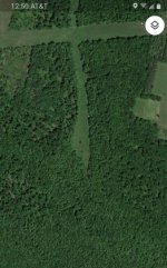
Hemlocks along small N and W running tribs, location described previous post this thread
 

Attachments

  • 20200810_122716_resized_1.jpg
    20200810_122716_resized_1.jpg
    49.2 KB · Views: 9
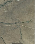
This is the example mentioned in the first post: West Creek in northern Columbia County. The individual tree species map linked post 1 shows that there's a good Hemlock forest here, but you need a satellite map to see that in this case it is unfortunately not there over a long section of the stream.
 

Attachments

  • 20200810_125149_resized.jpg
    20200810_125149_resized.jpg
    62 KB · Views: 10
K-Bob are you familiar with West Creek? My cousin's husband has a cabin called West Creek Cabin. Really interesting terrain and waterfalls. I think we caught one brook trout out of it on a couple tries. Some beautiful falls but at places it doesn't quite look like trout water. 1 of 2 times we were there it was really bad drought. I don't think there are many trout in it but he says it used to be stocked right behind the cabin.
 
I looked at part of west creek once where it is stocked with signs saying you can fish. this is maybe 1.5-2 mi south of 118, it was summer and water seemed a bit warm for wild trout. I assume the water was warm because I was downstream of the north-south running open area shown in post 4. one branch of west creek runs run through there.

but that open area is actually on the east branch of west creek, and the west branch of west creek from 118 to the point where those 2 branches meet looks brook trouty to me from maps. probably a small stream but I like those. catskill geology there, as it may buffer our acidic rain, is promising for trout.

however, the west branch of west creek was posted and the dirt road crossing it (mountain road?) was closed/bridge out? I think that east-west running pipeline clearance shown in my post 4 was posted also.

there was this large bear along a dirt road and great looking forests, tho.. beautiful area...

 
So the east branch of West Creek area shown in Post Number Four has a stream in a Hemlock Forest without hemlock trees over the stream,,,

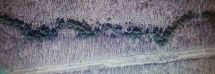
The solomon Creek trib area shown in post 3 has hemlocks on the stream without a surrounding Hemlock Forest... (can try to see if a stream may have hemlock canopy using the 2 maps linked post1)

image below/next post shows the shade hemlock trees can throw on a stream using that post 3/solomon creek trib area.. and can someone please put tons of limestone gravel on that power line Access Road! 🙂
 
Solomon creek trib/ hemlocks throwin some shade 🙂
 

Attachments

  • 20200811_081623_resized_2.jpg
    20200811_081623_resized_2.jpg
    115.2 KB · Views: 11
Top