Manada creek

Beweav

Beweav

Active member
Joined
Nov 26, 2022
Messages
145
Location
Harrisburg
I was wondering if anyone has fished here recently or if anyone had any more info about it. I fished there twice in the last couple days and got skunked both times. The first time was just below the DHALO and the second time was in the DHALO section. I didn’t even catch a fallfish! Is there still fish in there? All the talk about it on here is from around 2015. Did something happen since then or did I just have 2 bad days?
 
I was wondering if anyone has fished here recently or if anyone had any more info about it. I fished there twice in the last couple days and got skunked both times. The first time was just below the DHALO and the second time was in the DHALO section. I didn’t even catch a fallfish! Is there still fish in there? All the talk about it on here is from around 2015. Did something happen since then or did I just have 2 bad days?

IMO, Manada has declined in recent years. I've caught a number of different wild species in there at times, but it hasn't fished well for me the past several times I've fished it. Like many local streams, it suffers greatly during high water events, which seem to change it every time. However, in recent years I think it's been more low water/higher temp events that have affected it. It's a shame because it is a beautiful stream in places. I've written it off my list for now until things (hopefully) improve.
 
IMO, Manada has declined in recent years. I've caught a number of different wild species in there at times, but it hasn't fished well for me the past several times I've fished it. Like many local streams, it suffers greatly during high water events, which seem to change it every time. However, in recent years I think it's been more low water/higher temp events that have affected it. It's a shame because it is a beautiful stream in places. I've written it off my list for now until things (hopefully) improve.
It has some really nice parts of it for sure! It looks fishy in some sections then in others will be completely covered in sediment and slow.
Are the upper sections all on federal land or can you access it?
 
It has some really nice parts of it for sure! It looks fishy in some sections then in others will be completely covered in sediment and slow.
Are the upper sections all on federal land or can you access it?
The beginning of the DHALO area is the furthest point your allowed to fish. I've had the military police or whoever patrols that ground follow me the whole way up through the DHALO , I think the far side of the creek is federal ground once you get up in a ways
 
I live 7 or 8 miles from the DHALO section on Manada and might fish it once a year if that tells you anything.......seems to be really completely hit or miss but even when you hit decent flows and some active fish it is only OK on a good day. Damaging floods, banks collapsing, big log jams, etc have destroyed some of the best water and the silt has really filled in a lot of spots. The DHALO section continues to get fished with bait........I was in the DHALO section in early May and ran into two guys drinking beer and fishing worms with 3 stocked fish on a stringer so you have that as well. Having said all of that, try to fish it when it has some color and have low expectations and you will find some fish. A buddy of mine does well outside of the DHALO on stocked fish once you walk away from the bridges.
 
Try its neighbor the next mountain gap to the northeast. IMO it’s always outfished Manada, despite Manada having a special regs section.
 
I live 7 or 8 miles from the DHALO section on Manada and might fish it once a year if that tells you anything.......seems to be really completely hit or miss but even when you hit decent flows and some active fish it is only OK on a good day. Damaging floods, banks collapsing, big log jams, etc have destroyed some of the best water and the silt has really filled in a lot of spots. The DHALO section continues to get fished with bait........I was in the DHALO section in early May and ran into two guys drinking beer and fishing worms with 3 stocked fish on a stringer so you have that as well. Having said all of that, try to fish it when it has some color and have low expectations and you will find some fish. A buddy of mine does well outside of the DHALO on stocked fish once you walk away from the bridges.
That helpful for my pride to hear :ROFLMAO: I may try again someday since it kicked my butt... I have a hard time letting that slide, But it probably won't be for a while.
 
Are the upper sections all on federal land or can you access it?

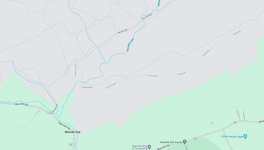
This shows the upper limit of fishable water. There are signs in the area, so it shouldn't be a surprise when you get up that far. This is posted land that isn't worth pushing your luck on 😂

Screenshot 2023 12 27 at 19 43 53 Trout Streams
 
This shows the upper limit of fishable water. There are signs in the area, so it shouldn't be a surprise when you get up that far. This is posted land that isn't worth pushing your luck on 😂

View attachment 1641233619
Thanks for this! I was under the impression that you couldn't fish passed the 443 bridge.
Still not quite far enough. I'd love to get way up into the headwaters. I wonder if the Gap ever gives permission to go up there. I'm assuming they don't.
 
Thanks for this! I was under the impression that you couldn't fish passed the 443 bridge.
Still not quite far enough. I'd love to get way up into the headwaters. I wonder if the Gap ever gives permission to go up there. I'm assuming they don't.
A few nice spots above the bridge
 
Your post caused me to go back through my archives and look through the various Manada trips I've taken over the years. I came across a few images that were worth sharing:

IMG 2249

One of the nicer wild browns from Manada I've caught (2021)

100 3472

This hole is a hot mess. Flooding caused much of the destruction you see here. There are always fish in this hole, but getting to them and landing them is a challenge!

100 3478

Likely a PFBC fingerling and not wild, but it still caught my attention.

IMG 20171003 105629479

A nice holdover brown (2017).
 
Your post caused me to go back through my archives and look through the various Manada trips I've taken over the years. I came across a few images that were worth sharing:

View attachment 1641233620
One of the nicer wild browns from Manada I've caught (2021)

View attachment 1641233621
This hole is a hot mess. Flooding caused much of the destruction you see here. There are always fish in this hole, but getting to them and landing them is a challenge!

View attachment 1641233622
Likely a PFBC fingerling and not wild, but it still caught my attention.

View attachment 1641233623
A nice holdover brown (2017).

The wild browns I've caught on the manada are beautiful fish , very vibrant colors, occasionally get brookies as well
 
We fished up past the first two roads into the gap when I was young and adventurous. Briarcrest must have been the first one. It was just a dirt road and there was a pipe hole on the downstream side. Then for some reason I picture the next road up as having a bridge you can walk under. We fished up past that a little ways. I remember fishing a hatch up there catching some native brookies.
Looking at google maps it is kind of shocking the number of roads and facilities that are up through the headwaters. I am guessing most of them are dirt roads that provide a ton silt. I hate to think what the military has disposed of up there. At least all those disturbances provide good habitat for the Regal Fritillary butterfly.
1703763403389
 
The upper areas of the stream look pretty nice. There isn't a ton of silt. I hunted that area quite a bit. You need a permit issued by the gap to be there. And then only certain areas are open. That changes daily.
Much of what is north of McClean Road is the impact area. No one, permit or not is allowed there. That's the headwaters area. No vehicle traffic. No people. Just unexploded ordinance.
 

Attachments

  • Screenshot 2023-12-28 at 9.03.52 AM.png
    Screenshot 2023-12-28 at 9.03.52 AM.png
    166.6 KB · Views: 25
The upper areas of the stream look pretty nice. There isn't a ton of silt. I hunted that area quite a bit. You need a permit issued by the gap to be there. And then only certain areas are open. That changes daily.
Much of what is north of McClean Road is the impact area. No one, permit or not is allowed there. That's the headwaters area. No vehicle traffic. No people. Just unexploded ordinance.
So you can potentially get a permit, that would be interesting!
Looking at google maps it is kind of shocking the number of roads and facilities that are up through the headwaters. I am guessing most of them are dirt roads that provide a ton silt. I hate to think what the military has disposed of up there.
Yeah I was wondering where all the silt comes from as well but I can Imagine whatever the military has going on up there has to be part of it. I looked around on google satellite view(which feels like a little bit like trespassing) and beyond all the stuff that we don't know happens up there that could impact the creek, it does look like a majority of the land surrounding the creek is clear cut and bare. That makes what I saw down on the lower sections make sense. The sandy sediment was thick down below the DHALO.
 
Last edited:
So you can potentially get a permit, that would be interesting!

Yeah I was wondering where all the silt comes from as well but I can Imagine whatever the military has going on up there has to be part of it. I looked around on google satellite view(which feels like a little bit like trespassing) and beyond all the stuff that we don't know happens up there that could impact the creek, it does look like a majority of the land surrounding the creek is clear cut and bare. That makes what I saw down on the lower sections make sense. The sandy sediment was thick down below the DHALO.
Flooding events have a significant impact on that stream. You can see what it does to the stream with respect to deposited debris/sedmiment, scoured banks, etc. Heck, even the bridge in one of my pictures was impacted by a high water event. There is no doubt that water comes down the creek with a vengeance!
 
There are tank firing ranges in the Gap and the tracks & trails are part of the problem with siltation.
 
Damaging floods, banks collapsing, big log jams, etc have destroyed some of the best water and the silt has really filled in a lot of spots.
I would humbly say that is what a healthy river does it moves and changes. If it doesn't change its a ditch. Trout love wood and the more log jams the more trout habitat.
 
Manada used to have a reproducing wild Brown Trout population. In fact Doc Fritchey TU posted signs about it in the Delayed harvest area. Unfortunately, I haven't caught a wild trout there in years.
 
Manada used to have a reproducing wild Brown Trout population. In fact Doc Fritchey TU posted signs about it in the Delayed harvest area. Unfortunately, I haven't caught a wild trout there in years.
Still some in there, beautiful genetics
 
Back
Top