J
JeffP
Well-known member
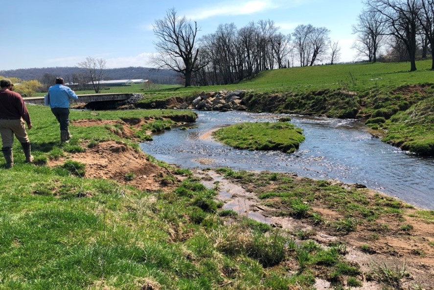
I had posted a bit ago about the big project planned for Hammer Creek. I signed up to volunteer and hope to do some testing in the near future. Doc Fritchey TU is running it and it sounds like a great project in a really good location. I know some seemed to react to Fishsticks posts about wild browns interfering with brook trout restoration. I am anxious to see how this project plays out as it sounds like helping the natives is definitely part of the plan. The reason I like the project is because it is a big one and in such a key area. I'm still finding out about the project, so as I learn more I will post. My goal is to get students involved from school that I teach at. One has already volunteered.
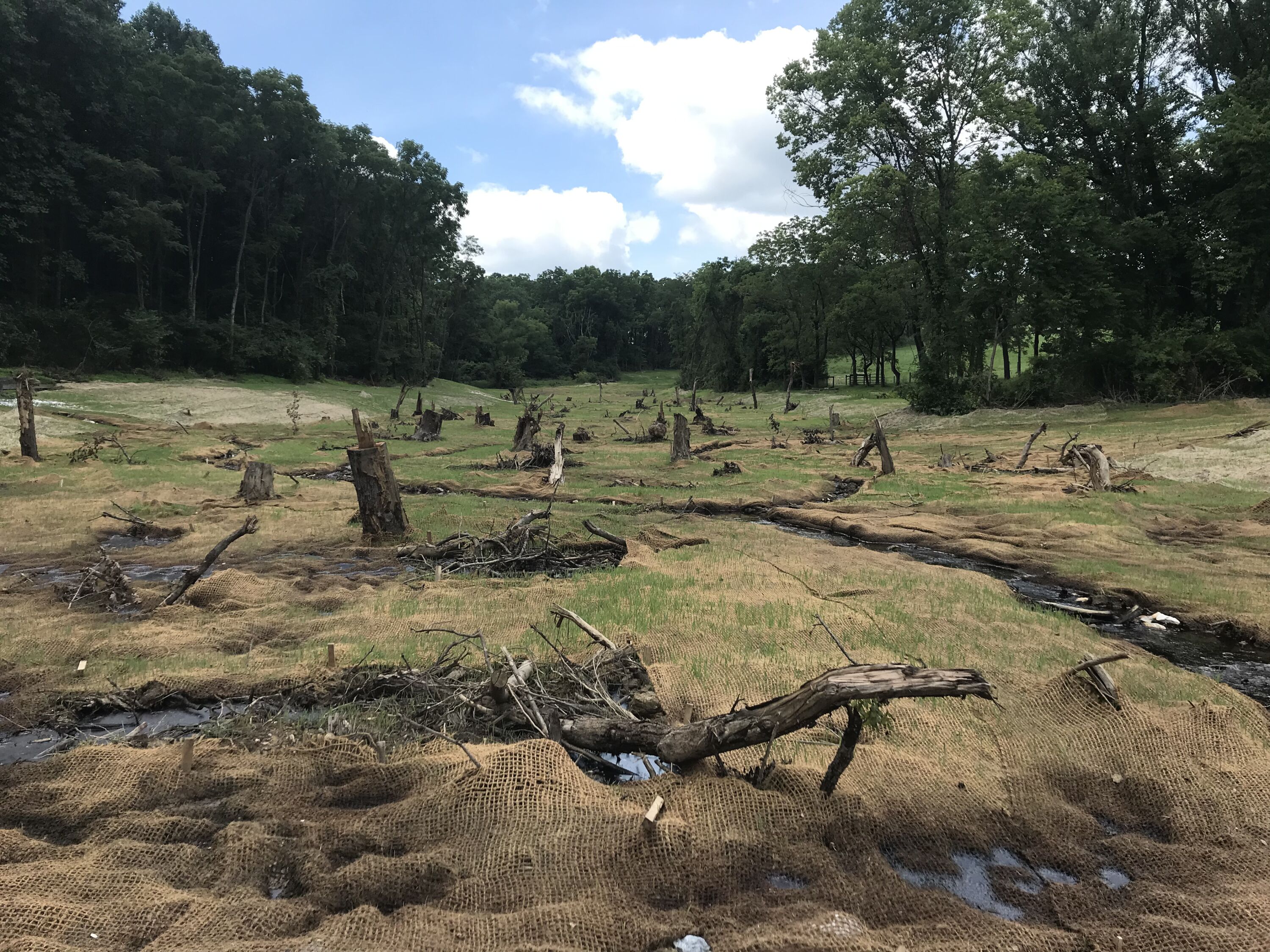
As I was telling by brother about the project, he said the legacy sediments projects is just awesome and that Clay Township (Lancaster County) just spent a bunch of grant money on an awesome project. I just hoped it wasn't where I just saw work done. Unfortunately it was. It is on lower Middle Creek on Brunnervile Road not far from where the Segloch dumps in. It was conducted at a ridiculously small place right on the downstream side of the bridge. There was a great hole to begin with and all they seemed to do was shave a bit of soil away and bolster the bank with that nasty limestone rock. Looks terrible, the whole is worse, and couldn't possibly be doing anything for the health of the stream. He's been a township superviser before, and has fought for a lot of environmental projects. I told him this seems like a total waste of money and there were plenty of stretches that MC could have really benefitted from. He said it was the only place they could find to do it. I don't know a ton about these projects, but it sure seems like money should be pooled and strategic locations should be identified. In talking with Russell Collins from DFTU, I found that a number of these projects are in the works. I was going to check out one somewhere on the headwaters of the Cocalico.
As I was telling by brother about the project, he said the legacy sediments projects is just awesome and that Clay Township (Lancaster County) just spent a bunch of grant money on an awesome project. I just hoped it wasn't where I just saw work done. Unfortunately it was. It is on lower Middle Creek on Brunnervile Road not far from where the Segloch dumps in. It was conducted at a ridiculously small place right on the downstream side of the bridge. There was a great hole to begin with and all they seemed to do was shave a bit of soil away and bolster the bank with that nasty limestone rock. Looks terrible, the whole is worse, and couldn't possibly be doing anything for the health of the stream. He's been a township superviser before, and has fought for a lot of environmental projects. I told him this seems like a total waste of money and there were plenty of stretches that MC could have really benefitted from. He said it was the only place they could find to do it. I don't know a ton about these projects, but it sure seems like money should be pooled and strategic locations should be identified. In talking with Russell Collins from DFTU, I found that a number of these projects are in the works. I was going to check out one somewhere on the headwaters of the Cocalico.