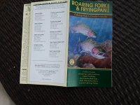
This map & guide is really helpful and critical ... especially for the Pan ... it shows all the c&r areas and public water all through the entire Gold Medal fishing area. one side of map is the Pan, the other is the RF... from glennwood springs all the way to independence pass. hopefully there is a current and updated edition. it would be a good idea to order one from 1 of the Basalt fly shops i mentioned above, then you can do some real research & planning prior to being there.
A few years ago i was on the Pan in late August. day before was 80 degrees, then a front moved in and it dropped to the 40s... with heavy clouds, rain then sleet. i was up near the Big K ranch section. bugs poured off the creek -- drakes, pmds, sulphers, isos, caddis, etc etc. had the whole river to myself. i caught so many feeshies ... i was exhausted when i stopped.
Really a cool place.