Sea Run Brook Trout Coalition - New Quarterly Newsletter

geebee

Active member
Joined
Oct 24, 2012
Messages
2,512
Yeah, some interesting conclusions in there from their long term tagging studies going back 20 years or more :

1. all stocked hatchery brookies entered saltwater at some stage.

2. brookies from the quashnet river stocked in the childs river, and one left the river, travelled along the coast to the quashnet river and then went back to the childs...

3. brookies moved more at night - which is consistent with sea run browns...

4. average size and number increased when browns no longer stocked over them.

5. brookies unlike salmon and trout can move into and out of saltwater seamlessly. maybe because they are char ? I have seen this myself - two salters raced up the creek, under the bridge and right up the falls into the freshwater stream.

6. brookies turn predator/carnivorous at a much younger age - love the herring pic. i think that means swing streamers for them....

7. movement is highest in spring and late November - this coincides with what i have read about ME, MD and NJ brown sea trout. The guys who fish them November to March in the day imho are doing it assed backwards. the 'fish of a thousand casts is a myth' imho.

GB
 
Fantastic stuff!

A century ago the brook trout of our large freestone streams made up and downstream movements with the seasons, just like salters. In "The Vanishing Trout" (published nearly a century ago) Charles Lose describes these movements and what the brook trout fishing was like in those times. Charles Wetzel, in "100 Pennsylvania Trout Streams and How to Fish Them," describes similar movements a hundred years ago in Kettle Creek. This was how brookies of Pennsylvania reached a foot more in length and occasionally even 20 inches in "The Good Old Days."

Now we treat these our freestones as Put-and Take waters because it is believed that they can no longer hold native brook trout. Apparently the folks in Massachusetts don't buy into this argument and are trying to restore their brook trout fishery. It begs the question: When is PA going to wake up to the potential of its wild brook trout fishery?
 
Ken,

I agree.

These brookies in MA, ME , CT, NY and Long island are more visible because these small streams dump straight into the sea, whereas in PA the brookies are in creeks, two or three tribs away from the coast.

The current issue over the Fire Island breach is a case in point - the EBTC plus the SRBTC and various other environmental groups fought and are fighting to keep the breach open, because the fresh water is clearing a polluted stagnant bay.

scientists have already noticed that the water there is now crystal clear ( good for sight fishing for stripers) and that bodes well for the three small streams - the connetquot, patchoque and carmens rivers that used to hold brookies.

the connection is direct - its much harder for folks to think about a stream up in SCPA and the rivers its a tributary to imho.
 
a bit of an update to this - local flyfisher and member of the SRBTC Ron Merly caught this in the last week at an CT river estuary:

TU-SALTER-2.jpg


i'm going to guess that is 18-20" - a hell of a Salter.


geebee wrote:
Ken,

I agree.

These brookies in MA, ME , CT, NY and Long island are more visible because these small streams dump straight into the sea, whereas in PA the brookies are in creeks, two or three tribs away from the coast.

Are you suggesting that sea run brookies exist in PA?

If you think so, why do you think so? Is there any evidence of that?

 
troutbert wrote:
geebee wrote:
Ken,

I agree.

These brookies in MA, ME , CT, NY and Long island are more visible because these small streams dump straight into the sea, whereas in PA the brookies are in creeks, two or three tribs away from the coast.

Are you suggesting that sea run brookies exist in PA?

If you think so, why do you think so? Is there any evidence of that?

no, but its possible. but unlikely i think - my point was that brookies up in the PA mountains get less love than sea runs because there is a greater degree of separation.

I would guess that before the susquehanna and delaware were industrialised and dammed there may well have been a salter run ?

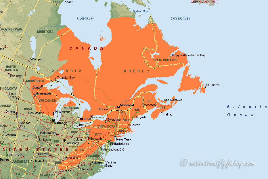
if you look at the map - the susky and delaware were in the bottom of the original range , so the Cristina, Brandywine etc may well have had salter runs :

brooktroutmap.jpg


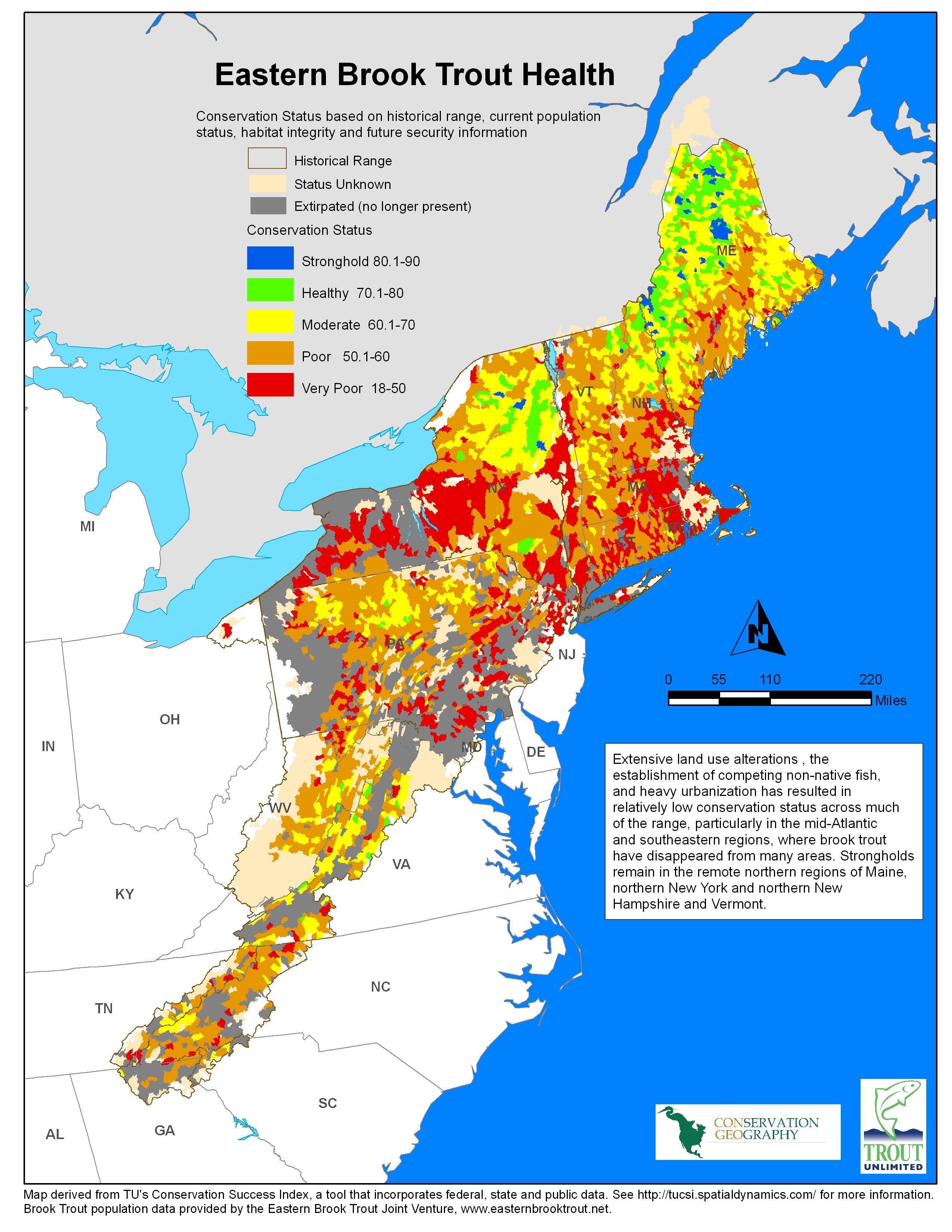
looking at the current map - guess which state is the most degraded ? :

brook-trout-map.jpg


if you look at the Chesapeake Bay foundations new approach - one stream at a time is not enough, they are dead on !

people do not get the connection between slate run say and the Chesapeake Bay...
 
Top